River Katun
Katun river (regions Maima, Chemal, Ongudai, Ust-Koksa) is the main water arteria of the Altay Mountains. It is very popular among those who is fond of white water rafting, river rafting tours as well as recreation holidays in the Altay Mountains. Katun is translated as "woman, mistress" from the Turkic language. The river is 688 km long. The Katun river originates in the southern sloep of the Katun mountain range of the Belukha Mountain near the Gebler glacier.
The river is divided into three sections: Upper Katun from the head to the river Koksa with the length of 210 km; Middle Katun from the river Koksa estuary to the river Sumulta with the length of 200 km; Lower Katun with the lenth of 280 km from the river Sumulta to the confluence with the rive Biya.
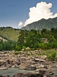
At the upper section the river Katun turns around the Katun mountain range from its south and west sides and has the steepest slopes of about 1000 m declention. At this section the Katun invlolves a lot of tributaries from the southern and western slopes of Katun mountain range. In this regions the forests belong to Black taiga type.
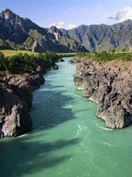
Middle katun from the river Koksa to the river Sumulta flows along the high mountain ranges. The general declention of the river at this section is about 400 m. The river accepts the main ice-origin tributaries: the rivers Multa, Kuragan, Akkem, Kucherla, Argut and Chuya. Lower the village T'ungur till the river Argut the river Katun flows along the gorge full of rapids. Deciduous forests dominate at the Middle section of the Katun river.
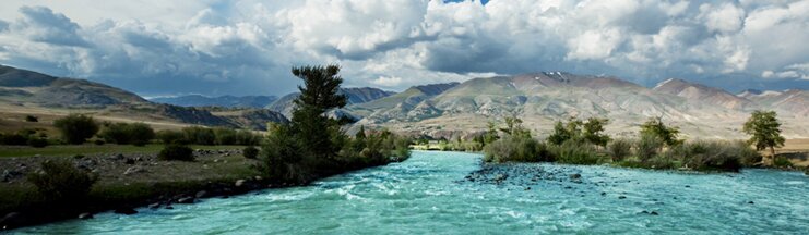
Lower Katun from Sumulta river to the estuary is located in the region of middle-hill and low-hill terrains. The river's general declention is about 400 m. The dominant type of the nature in this part is a lot of terrases. From the tributaries the most important rivers on this section are Chemal and Sema rivers. THe valleys' slopes are covered with larches. Pine-trees appear from the Sumulta's estuary.
Lower the village Maima the river Katun turns into the valley river. The general declention from the headwaters to the estuary is 2000 m. Interflowing with the river Biya the river Katun creats Ob river - one of the most powerful and largest river of Siberia.